🎉 Up to 70% Off Selected ItemsShop Sale


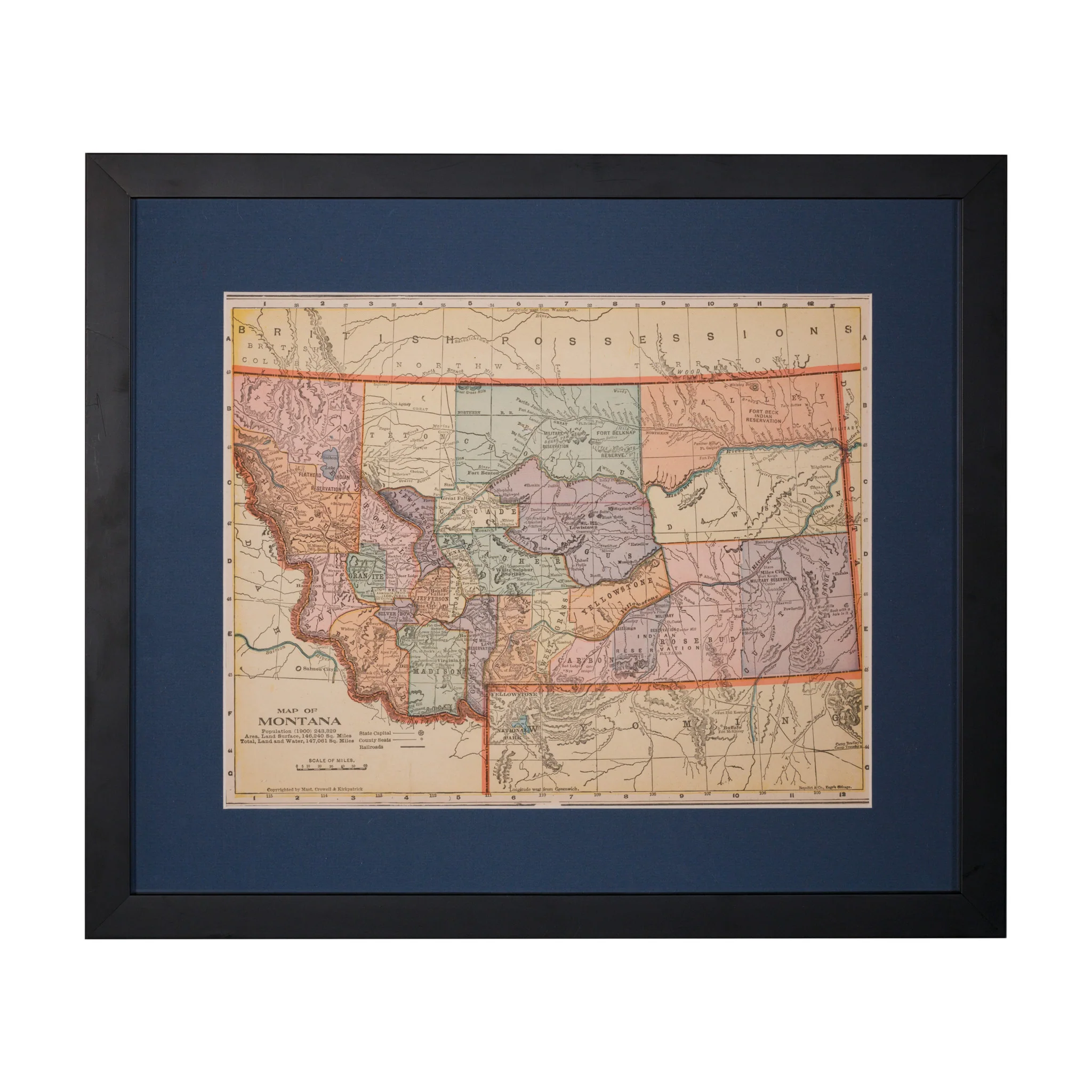
Map of Montana (1897 - 1900)
(1897 - 1900) Map of Montana showing 24 counties and the territory between Butte an Helena. Produced by Rand, McNally & Co. 9 1/2" x 12 1/2"
PERIOD: Late 19th Century
ORIGIN: Montana, United States
SIZE: 9 1/2" x 12 1/2"
$315.00
Original: $900.00
-65%Map of Montana (1897 - 1900)—
$900.00
$315.00Product Information
Product Information
Shipping & Returns
Shipping & Returns
Description
(1897 - 1900) Map of Montana showing 24 counties and the territory between Butte an Helena. Produced by Rand, McNally & Co. 9 1/2" x 12 1/2"
PERIOD: Late 19th Century
ORIGIN: Montana, United States
SIZE: 9 1/2" x 12 1/2"