🎉 Up to 70% Off Selected ItemsShop Sale


Map of Utah and Nevada County 1867
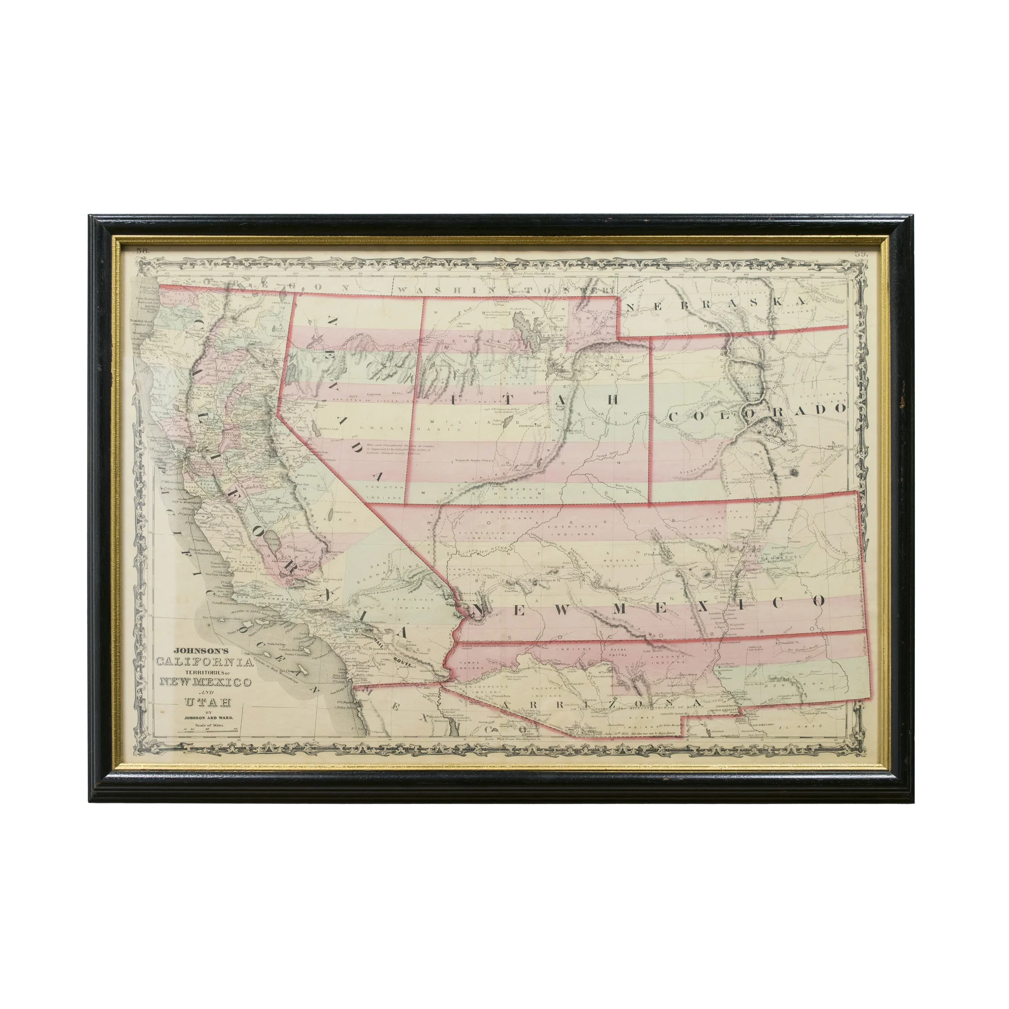
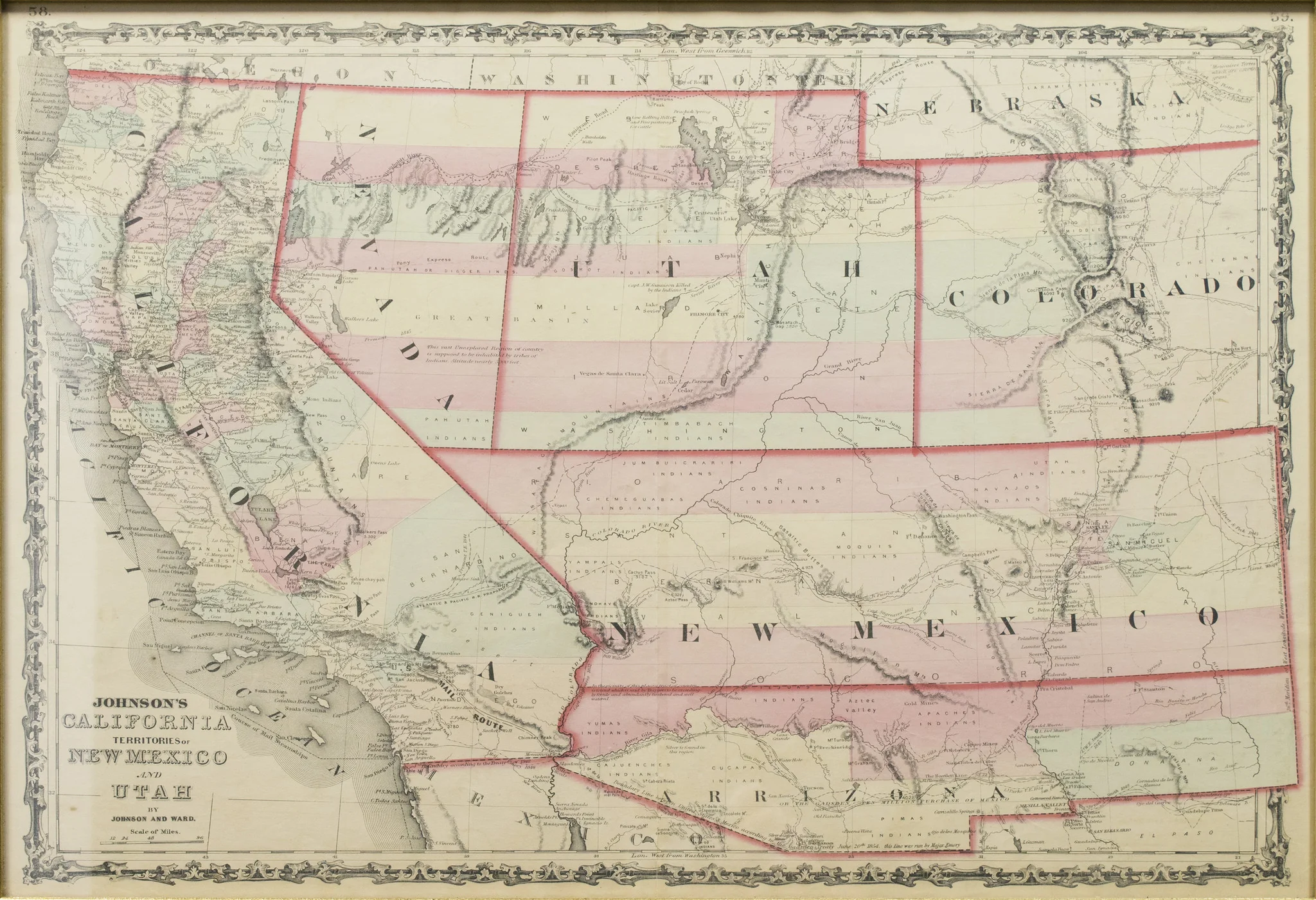
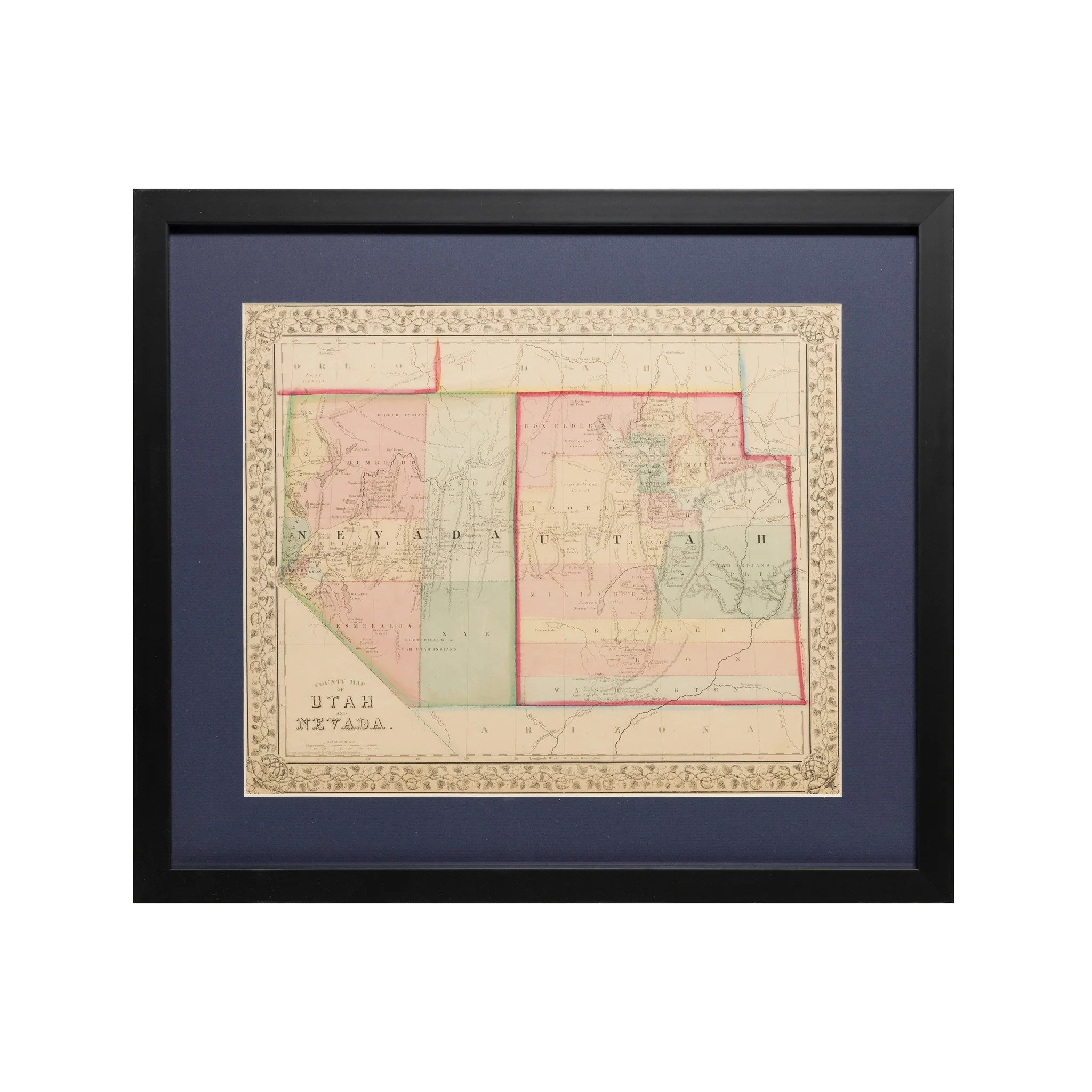
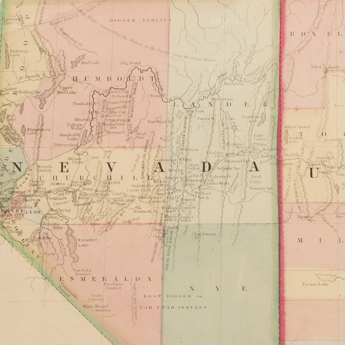
County map of Utah and Nevada. This map drawn and engraved by W.H. Gamble Philadelphia. "Entered according to Act of Congress in the year 1867 by S. Augustus Mitchell Jr…" Scale is about 46 mile per inch. The state of Nevada shows about eight counties including Roop, but no southern tip on Nevada. The original Immigrant Trail is shown, but no railroads. Utah has about fifteen counties. Chipping on bottom edge not distracting.
PERIOD: Mid 19th Century
ORIGIN: Philadelphia, United States
SIZE: 12 1/2" x 10"
$875.00
Original: $2,500.00
-65%Map of Utah and Nevada County 1867—
$2,500.00
$875.00Product Information
Product Information
Shipping & Returns
Shipping & Returns
Description
County map of Utah and Nevada. This map drawn and engraved by W.H. Gamble Philadelphia. "Entered according to Act of Congress in the year 1867 by S. Augustus Mitchell Jr…" Scale is about 46 mile per inch. The state of Nevada shows about eight counties including Roop, but no southern tip on Nevada. The original Immigrant Trail is shown, but no railroads. Utah has about fifteen counties. Chipping on bottom edge not distracting.
PERIOD: Mid 19th Century
ORIGIN: Philadelphia, United States
SIZE: 12 1/2" x 10"